Europe's lost landscape
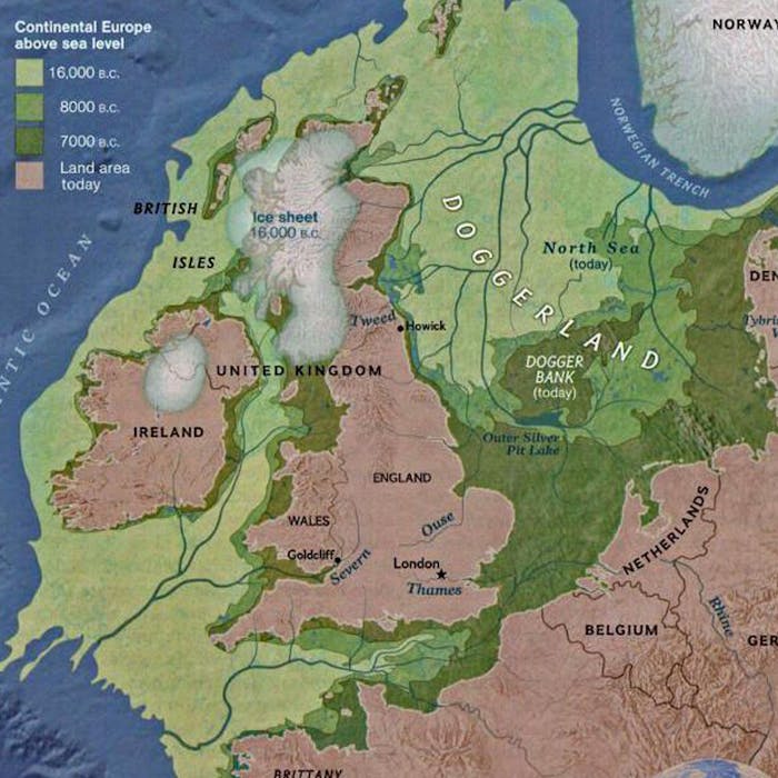
A lost land lies under the North Sea. Until 12,000 years ago, Britain was joined to the rest of Northern Europe by a vast expanse of hills, marshland, heavily wooded valleys, and swampy lagoons called D0ggerland.
It is believed to have been a rich habitat, with lions, mammoths and deer, as well as human hunters and Neanderthals.
Tantalising evidence of the life that once existed beneath the waves, including ancient bones and tools, has been brought to the surface over the years by fishing trawlers.
The Rhine, Scheldt, and Thames rivers once met to form the Channel river and flow out into the Atlantic.
D0ggerland was gradually innundated by the melting of the ice sheets at the end of the Ice Age.
One last large island remained between Denmark and Britain. It is believed that it was finally flooded by a tsunami, triggered by a landslide off the coast of Norway, in around 6150 B.C. This shallow area is now known as D0gger Bank.
Further reading
Links to external websites are not maintained by Bite Sized Britain. They are provided to give users access to additional information. Bite Sized Britain is not responsible for the content of these external websites.