Mourne Mountains - Northern Ireland's dramatic high spot
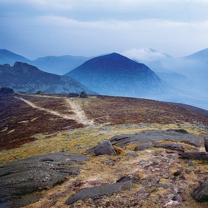
The Mourne Mountains are the highest and most dramatic mountain range in Northern Ireland, their summits crowned by granite tors. The mountains themselves are criss-crossed by a network of paths and tracks, which have led it to be voted the ‘Best Walking Destination’ in Northern Ireland.
The Mournes are divided into two very distinctive areas – the Eastern or ‘High’ Mournes and the Western or ‘Low’ Mournes. Any newcomer will likely be amazed at the variety of landscapes within such a confined geographical area.
The Mourne Mountains are in County Down, lying inland from the Irish Sea coast 31 miles south of Belfast and just over 62 miles north of Dublin. They contain twelve peaks over 600 metres in height and include Slieve Donard, Northern Ireland’s highest mountain at 850m. To the north the Slieve Croob Massif stands out as distinct rocky summits with thin grass cover and shattered rocky screes. The land rises to a height of 534m at Slieve Croob.
While granite mountains dominate the Mournes, much of the area, like most of County Down, is underlain by Silurian rocks of shales, mudstones or greywackes. These formed over 420 million years ago, from mud, sands and silts lying at the bottom of an ocean known as the Iapetus Sea, which once separated Scotland and Northern Ireland from England, Wales and Southern Ireland.
The high Mournes granites developed 56 million years ago, during a time of much volcanic activity as the great continents moved apart leaving what is now the North East Atlantic Ocean. This was also the time when other famous geological features formed in Northern Ireland, including the Giants Causeway and the Ring of Gullion.
The mountains formed out of molten magma, rock from the earth’s centre, but they were not volcanoes. The molten rock never quite broke through the Earth's surface as lava, but bubbled up inside the Earth's crust and slowly cooled beneath the overlying sandstone into the interlocking crystals of quartz, feldspar and mica that form granite. The granite mass that is now exposed was formed when blocks of Silurian shale subsided, leaving a cavity which was filled by an up welling of acid magma. Much older than the high Mourne granites, however, is the Newry Granodiorite complex, which crystallised in the Caledonian period - about 400 million years ago - in association with the closure of the ancient Iapetus Sea. These granites are seen in the summits of Slieve Croob and Slievenisky and much of the hilly landscape north and west of Castlewellan.
Examples of human activity includes the Mourne Wall, originally built in an effort to keep cattle and sheep out of the water catchment area of the Silent Valley reservoir. Completed in 1922, it took over 18 years to complete with many skilled locals seasonally employed to build this stone wall which still stands up to 8ft high and 3ft wide. It is 22 miles (35.5km) in length and connects the summits of no less than 15 mountains in the Mournes, including Slieve Donard.
During the 18th and 19th Centuries illegal cargo ships stocked full of illicit packages of tobacco, wine, spirits, leather, silk and spices docked at the foot of the Mournes in the port of Newcastle. Smugglers then loaded ponies with these illegal products and trekked through the Mourne Mountains to Hilltown. Trade was so popular and the route so widely used that a track was soon created by the hooves of the heavily laden ponies. This old smugglers track still exists today and is used as a popular walking route, aptly know as “The Brandy Pad”.
There are two widely renowned walking festivals which take place annually in the Mourne Mountains; The Mourne International Walking Festival and the Wee Binnian Walking Festival.
Further reading
Links to external websites are not maintained by Bite Sized Britain. They are provided to give users access to additional information. Bite Sized Britain is not responsible for the content of these external websites.