Numbering Britain's road system - where would we be without it?
Historically UK roads were not numbered, but named. As traffic increased and became motorised, local authorities found it difficult to keep track of maintenance work and travellers had trouble finding their way around because road signs were inconsistent and often hard to see from a motor vehicle. In the early 20th century, it was decided a more systematic approach was needed - now exactly 100 years ago.
In 1910, spurred by the arrival of the motor car, the authorities decided to act. A government body called the Roads Board was set up under William Rees Jeffries, instructed to upgrade and classify existing roads and build new ones using money from the new road and petrol taxes.
It was fairly quickly realised that a numbering system would also be useful for navigation. The newly created Ministry of Transport (MOT) set about identifying which roads needed funding, and numbering them. There were to be two classes of roads: A roads, more important with more funding, and B roads of lesser importance.
By 1921 the MOT had identified the system for England and classified 97 main A roads, with one or two digit numbers. Some of these were soon published on Michelin and Bartholomews maps, much to the Ministry's irritation - and to Bartholomew's irritation as some of the numbers then changed.
The formal classification was not published until 1923, in a little booklet published by HMSO. The Ordnance Survey published an accompanying series of maps - the MOT series, and several other mapmakers published revised road maps. The road numbers also went up on signs.
In England 6 main radial 'A routes' out of London were identified:
A1: London - Newcastle - Berwick (and on to Edinburgh); A2: London - Dover; A3: London - Portsmouth; A4: London - Bath (London - Bristol, writes Christopher Larsen); A5: London - Holyhead; A6: London - Leicester - Manchester - Carlisle
Roads starting in the zone east of road A1 were given numbers beginning with 1; south of the A2 numbers beginning with 2, west of the A3 with 3 and so on. There were exceptions - roads starting in North Kent began with 2, and the A40 between the city and Marble Arch marked the southern boundary of roads beginning with 5.
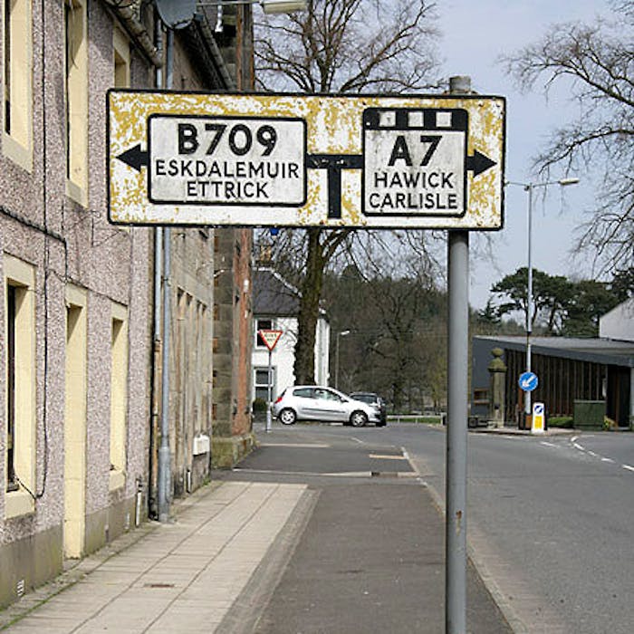
In Scotland 3 main radial routes out of Edinburgh were identified: A7: Edinburgh - Carlisle; A8: Edinburgh - Glasgow - Greenock; A9: Edinburgh - Inverness.
Roads which began in one zone but continued across several others maintained their initial number - thus the A46 begins in zone 4 in Bath, but keeps the same number despite crossing into zones 5,6 and 1 on its way to Grimsby.
Further reading
Links to external websites are not maintained by Bite Sized Britain. They are provided to give users access to additional information. Bite Sized Britain is not responsible for the content of these external websites.